


Hiking in Cabo: the trails that exist, who can use them and when to go
Where you can hike around Cabo San Lucas, which trails need a guide, how to handle the heat, and why the Arch takes a boat.
In this guide
- Which hikes can you do around Cabo?
- The Land's End hike: Cerro del Vigía, also called Mount Solmar
- Can you hike to the Arch or to Lover's Beach?
- Cañón de la Zorra: a waterfall 1.5 hours from Cabo
- Sierra de la Laguna: overnight hikes in the mountains
- When is the best time to hike in Cabo?
- Do you need a guide, and what about hiking tours?
- What a hike can't show you, and a boat can
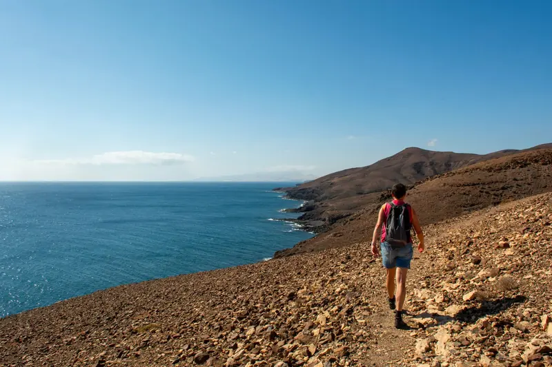
Cabo hiking comes down to three real options. There's a short, steep hill at Land's End that you can only climb with its owner as guide, usually at 8 AM. There's a waterfall canyon about 1.5 hours away by car. And there's the Sierra de la Laguna, a mountain range with overnight routes for people who came to Baja to walk. You can't hike to the Arch, because there is no trail to it.
Cabo San Lucas is a desert town on a rocky point, and most of the coast around it is either private or protected. So the list of trails is short, and each one has an access rule you should know before you lace up.
Which hikes can you do around Cabo?
| Hike | From Cabo San Lucas | Effort | Access |
|---|---|---|---|
| Cerro del Vigía (Mount Solmar) | Walk from the marina | 1.5 to 2 hours, steep | Private, guided only |
| Lover's Beach to Divorce Beach | 1 mile by boat | A few minutes on sand | By boat |
| Cañón de la Zorra waterfall | About 1.5 hours by car | Steep 10 minute walk | Through a private ranch, entry fee |
| Sierra de la Laguna | 1.5 hours or more by car | Overnight | Local guide advised |
The Land's End hike: Cerro del Vigía, also called Mount Solmar
This is the hike people mean when they search for a Cabo Land's End hike. Cerro del Vigía is the hill that rises behind the marina and looks down on both sides of the cape. Visitors usually call it Mount Solmar.
The hill is private property, and there's no public trailhead. The only way up is with the owner, who runs a dog training camp at the foot of the hill, near the far end of the marina boulevard. He leads the walk himself, and his dogs often come along.
What we could confirm for 2026:
- The walk was running, with one group most days at 8:00 AM, Sunday to Friday, and no walk on Saturday.
- It's free. People leave a tip for the guide.
- There are no reservations. You show up about 15 minutes early.
- Days and hours change through the year, and reports about afternoon or sunset walks don't agree with each other. The current schedule is posted on the Facebook page "Ascenso al Cerro del Vigía".
The route is short. AllTrails lists it at about 1 mile with roughly 380 ft (116 m) of climbing, and most people take 1.5 to 2 hours with stops. It's short but not easy. The last part is steep enough that you use your hands, the rock is loose and dusty, and there's no shade.
From the top you see the bay, Médano Beach, the marina, and Lover's Beach and Divorce Beach side by side, with the Pacific on one side and the Sea of Cortez on the other. In winter you may spot whales from up there.
Wear closed shoes with grip, never sandals. Bring water and a hat, and keep both hands free for the top section.
Can you hike to the Arch or to Lover's Beach?
No, and this is the question we get most.
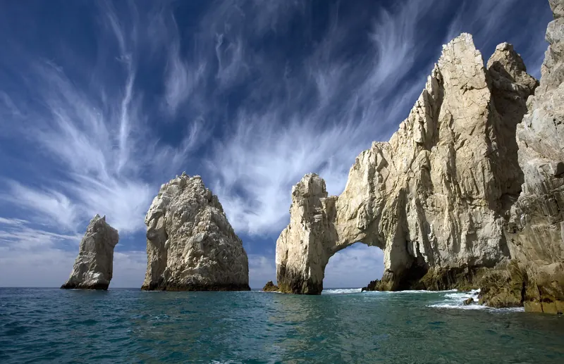
The Arch stands at the very tip of Land's End. On a normal day you can't walk to it. The land there is a sliver of a federal protected area: Cerro del Vigía, the Arch and two islets add up to a little over 19 hectares (47 acres), inside a reserve of 3,996 hectares (about 9,870 acres) that is roughly 95% sea. CONANP, Mexico's protected areas agency, lists climbing the rock formations as not allowed in its draft management program.
Every four to five years a strip of sand forms under the Arch and looks walkable. The municipal beach authority calls it extremely dangerous, because waves and tides change without warning. It came back in August 2026, and Civil Protection raised black flags and closed the area under the Arch and Divorce Beach because of heavy surf.
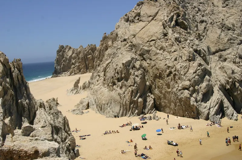
Lover's Beach is reached by boat. Don't try to get there over the rocks from the Pacific side. That coast has big surf and a strong undertow, and the rocks are the same formations the protected area asks people not to climb.
There is one walk worth doing out there, and it starts from a boat. Once you're on Lover's Beach, a short walk across the sand takes you to Divorce Beach on the open Pacific. It's the largest of the beaches at Land's End, with waves rolling straight in from the ocean. Walk it, take photos, and stay out of the water on that side. There are no lifeguards and no services on either beach.
Cañón de la Zorra: a waterfall 1.5 hours from Cabo
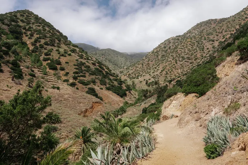
If you want green instead of granite, drive to the East Cape. Cañón de la Zorra is outside the small town of Santiago, on the edge of the Sierra de la Laguna reserve, about 1.5 hours from Cabo San Lucas.
From Santiago you follow the signs for about 10 km (6.2 miles) to a private ranch, which is the entrance. You pay an entry fee there and get directions to the trail. The walk down to the falls takes about 10 minutes and is steep. There are steps cut into the rock now, but it's still a moderate effort, especially coming back up in the heat.
At the bottom is a waterfall of about 10 m (33 ft) that drops into natural pools. You can swim, and people spread out on the smooth granite around the water.
It's more of a swim with a short hike attached than a day of walking. Bring pesos for the entry, water shoes if you have them, and enough drinking water for the drive home. On the way you pass the Tropic of Cancer monument on Highway 1, just south of the Santiago turnoff, which makes a quick stop.
Our guide to day trips from Cabo has other drives you can pair with it.
Sierra de la Laguna: overnight hikes in the mountains
The Sierra de la Laguna is the range that fills the middle of the peninsula's tip, between the Pacific and the Sea of Cortez. Mexico declared it a biosphere reserve by presidential decree on June 6, 1994.
It's a different Baja from the one at the beach. The high point of the range is 2,080 m (6,830 ft), the highest in Baja California Sur. Oak woodland takes over above 800 m, and pine and oak forest above 1,600 m (5,200 ft).
The classic route is an overnight hike to the high meadow near Picacho de la Laguna, usually approached from the western side of the range, near Todos Santos. Canyons on the eastern side, reached from towns such as Santiago and Miraflores, give other ways in.
This isn't a walk to add between the pool and dinner. Distances are long, few of the trails are mapped and help is far away. If the sierra is why you came, hire a local guide who knows the route and the water sources, and plan it as its own trip. If you only have a day, a visit to Todos Santos gets you to the foot of the range without the climb.
When is the best time to hike in Cabo?
November to April. The numbers below are 10-year averages from our trip guide.
| Months | Average high | Rainy days | Hiking |
|---|---|---|---|
| January to April | 77 to 80°F (25 to 27°C) | 1 to 5% | Best |
| May and June | 81 to 84°F (27 to 29°C) | 2 to 5% | Good, start early |
| July to September | 88°F (31°C) | 10 to 34% | Sunrise only |
| October to December | 79 to 87°F (26 to 31°C) | 5 to 10% | Good from November |
Whatever the month, start early. There's almost no shade on desert trails here, and the sun is strong by mid-morning. Sunrise is about 7:03 AM in mid-January, 5:59 AM in mid-April and 5:34 AM in mid-June, Cabo time, so in the warm months a good start means being on the trail around 6.
A few habits that matter more here than at home:
- Carry more water than you think you need, at least a liter per person even for a short climb.
- Wear a hat and sunscreen, and cover your shoulders.
- Wear shoes with grip. Decomposed granite is slippery going down.
- In August and September, check the forecast. Rain is rare most of the year but falls on about a third of days in those two months.
Do you need a guide, and what about hiking tours?
For Cerro del Vigía you have no choice: the owner is the guide. For Cañón de la Zorra you can drive yourself and pay at the ranch. For the Sierra de la Laguna, go with a guide.
Guided hiking tours from Cabo usually bundle the drive, the entry fees and water. Before you book one, ask how big the group is, how much of the day is spent in the van, and whether the entry fees are in the price.
What a hike can't show you, and a boat can
The hill at Land's End gives you the view from above. It doesn't get you close to the Arch, the sea lion colony or the sand at Lover's Beach, and nothing on foot does. Those are 1 to 1.3 miles from the marina by water.
The two fit in one day. Climb at 8 AM, be back in town by 10, and take a boat in the afternoon or at sunset to see from sea level what you just saw from the top. Our 2 hour Arch & Land's End route passes Pelican Rock, the sea lions, the Arch, Lover's Beach and Divorce Beach, 4.7 miles (7.6 km) round trip. Our article on the Arch explains what you're looking at.
Boats that suit a small group after a morning hike:
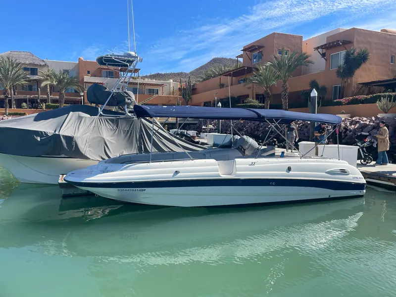
- The Chaparral 28, a 28 ft sport boat for up to 10 guests, from USD 519 (MXN 9,799) for 2 hours, with snorkel gear and a floating mat.
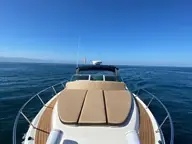
- The Bayliner 33, a 33 ft express cruiser for up to 8, from USD 599 (MXN 11,399) for 2 hours, with ice, bottled water, a floating mat and snorkel gear.
- The Sea Ray 36, a 36 ft express cruiser for up to 12, from USD 659 (MXN 12,599) for 2 hours, with a captain and deckhand, water, ice, towels and snorkel gear.
Prices are per boat for your whole group, with the 16% tax included. The customary 15% crew tip isn't included.
Send your date and group size through the planner. We reply in writing within 2 hours, between 8 AM and 8 PM Cabo time, and you pay through a secure Stripe link once the date is confirmed.
Yachts in this guide


Questions people ask
Can you hike to the Arch in Cabo San Lucas?
No. There is no trail to the Arch, and CONANP's draft management program lists climbing the rock formations at Land's End as not allowed. The Arch is 1.2 miles (1.9 km) from the marina by water, so people see it by boat.
Is the Mount Solmar hike open?
It was running in 2026, but only as a guided walk. The hill is private property, and the owner leads one group most mornings at 8 AM, Sunday to Friday. The schedule changes, so check it before you go.
What is the best time of year for hiking in Cabo?
November to April. Average highs are 77 to 80°F (25 to 27°C) from January to April, compared with 88°F (31°C) in July, August and September. Start at or near sunrise in any month.
Are there waterfalls near Cabo San Lucas?
Yes. Cañón de la Zorra, outside the town of Santiago, has a waterfall of about 33 ft (10 m) with pools you can swim in. It is around 1.5 hours by car from Cabo San Lucas.
Do I need a guide to hike in Cabo?
For the hill at Land's End, yes, because access is only with the owner. For the Sierra de la Laguna, a local guide is the sensible choice: the main summit route is an overnight trip in remote mountains.
Plan your day on the water
Pick a yacht, the hours and the food in the planner. A written reply within 2 hours, 8 AM to 8 PM Cabo time.
Keep reading
Beaches and snorkelingThe Arch Cabo San Lucas: Did It Collapse? How to See ItThe Arch is still standing. How it formed, why sand sometimes appears under it, and the easiest way to see it from the water.7 min read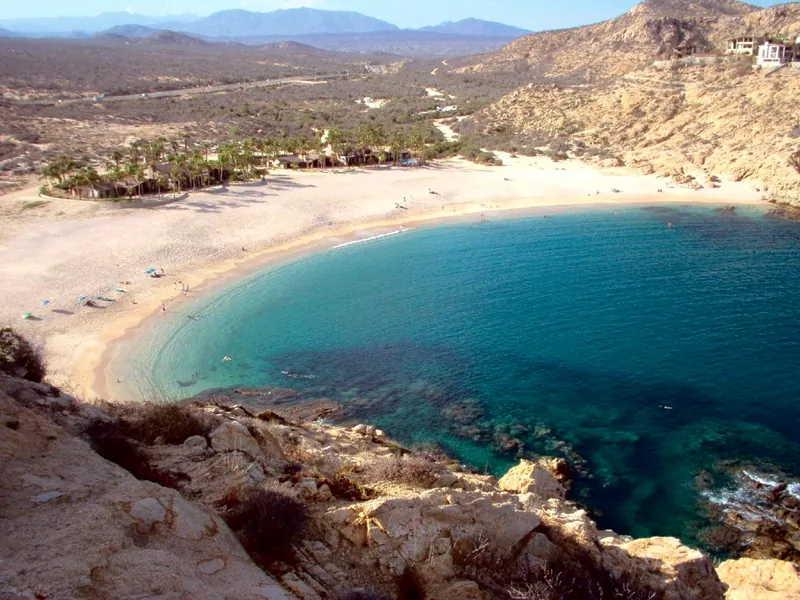 Things to doDay Trips from Cabo San Lucas: Drive Times and PicksFour day trips by road and one by sea from Cabo San Lucas, with drive times and who each one suits.8 min read
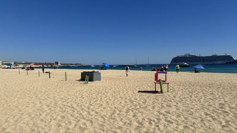 Things to doFree Things to Do in Cabo San Lucas (and One Worth Paying)Nine things in Cabo that cost nothing, from public beaches to whales from shore, and the per-person math on the one splurge worth it.7 min read